-
 Michigan Bronco Club
Trails and Parks
Trails contributed by our fellow Bronco owners around the great State of Mchigan. If you have any you'd like to add or any corrections, please shoot us a note.
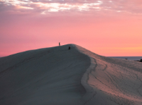
Silver Lake State Park ORV Area
Silver Lake State Park is home to this 500-acre ORV (scramble) area – the only sand dune riding opportunity east of the Mississippi River. Technically speaking, the dunes are not considered a designated trail.
- Duration: N/A (Park)
- Challenging
Bundy Hill
Bundy Hill Off Road Park is located on 350 acres in Jerome, Michigan just West of the corner of US-12 and US-127. We have all terrain for all OHV & ATV's. Bundy Hill is the Southeastern Michigan's Largest Privately Owned Off-road adventure park, full of winding wooded trails, sand, rock crawling, gravel hills, bottomless mud pits hood deep water, and hill climbs. They are constantly doing work to make sure you can find everything from mild to wild! In addition to this, member primitive camping is available during regular summer hours. We have rangers on duty to make sure our quests stay...
- Duration: N/A (Park)
- Challenging
Holly Oaks ORV Park
After years of planning, an off-road vehicle park in Oakland County, the 106-acre Holly Oaks ORV Park opened Sept. 17, 2020. The park is a joint State-County project, operated by Oakland County Parks and Recreation in partnership with the Michigan Department of Natural Resources via a 20-year operating agreement (with a 10-year renewal). The park, consisting of former and active sand and gravel mines, is located off I-75 (at Grange Hall) and Dixie Highway across from Groveland Oaks County Park and Campground. Holly Oaks is open to all types of ORVs, including full-size vehicles, side-by-sides, all-terrain vehicles or ATVs and motorcycles. Additional...
- Duration: N/A (Park)
- Challenging
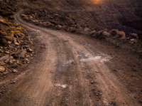
Denton Creek ORV Route
Dual use ORV Route and Snowmobile trail south of Houghton Lake. The 32 miles of trail is situated south of Waco Road and north of Grass Lake Roads from Old 27 past M-18 to Emery Road. The sandy trail can be seasonally wet due to the numerous wildlife flooding and creeks in the area. The route has very little elevation changes but does wind and twist through predominately oak, pine and lowland tree cover types.
- Duration: 2 Hours
- Moderate
Tawas Point State Park
Tawas Point State Park, located on the end of a sand spit that forms Tawas Bay along Lake Huron, is home to 183 acres of lakeside recreation and has been referred to as the “Cape Cod of the Midwest.” While this location is not an ORV park or, it is the starting point for our 2022 MBC Fall Color ride. The park is a stopover site for hundreds of migrating birds in the spring and fall, making it a favorite spot for many bird watchers from all over the Midwest. Pet-friendly shoreline.
- Duration: N/A (Park)
- Mild